



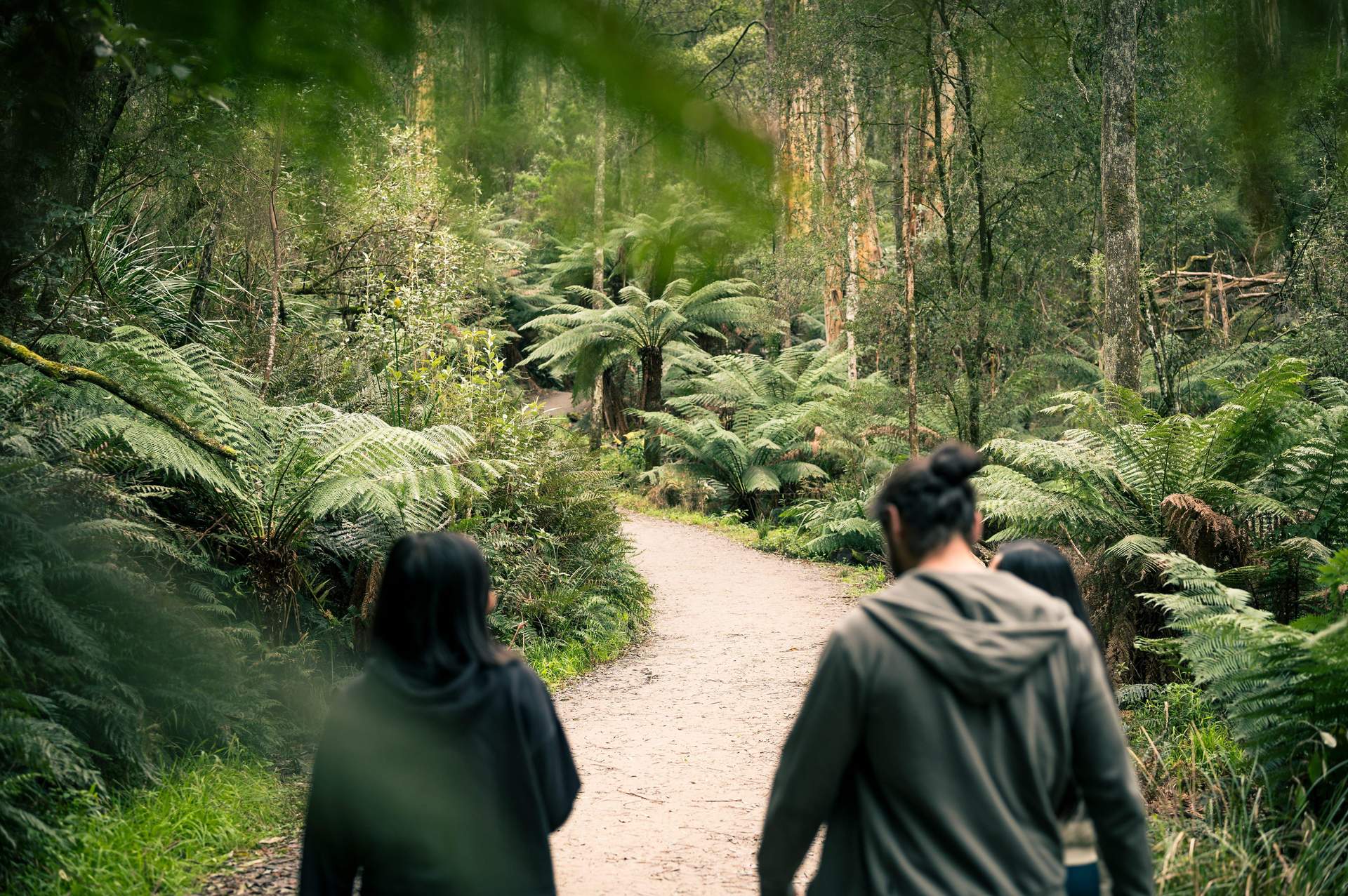
Walking & Hiking
Blessed with varying terrain and topography, the Yarra Valley, Dandenongs, Cardinia, Warburton and Nillumbik provides visitors with stunning State and National Parks to experience any number of walks and trails, suiting many abilities. There are dog-friendly trails, accessible trails, kid-friendly trails and lots of places you’ll keep coming back to time and time again.
Whether you’re visiting for the day, for the first time or staying in the region for that overdue break, there’s so much to explore. The hardest part is picking what to do first!

With 120 featured walks and trails, the Walking Trails of the Yarra Valley and Dandenong Ranges eGuide offers walkers, hikers and riders beautifully scenic places to visit – some just an hour out from Melbourne! Click below to see a Preview of the Guide and then you can purchase your digital copy for only $19.
Walk

Mt Everard Circuit
The Mt Everard Circuit Walk is approximately 22 kilometres in length so allow five to six hours to complete. It resides in the Kinglake National…

Californian Redwood Forest
Take a refreshing walk through the majestic Californian Redwood Forest, just 15 minutes from Warburton and a 90-minute drive from Melbourne's CBD. Do…

Morleys Track - Dom Dom Saddle
Length9.3 km (one way) - Starts Dom Dom Saddle, Ends FernshawTime3.5 hoursGradeMediumVictoria's tall Mountain Ash grow to a height greater than 90…

O'Shannassy Aqueduct Trail
Carved into the mountainside above the Upper Yarra Valley, the O’Shannassy Aqueduct trail is a 30-kilometre walking and bike-riding trail from East…

Kurth Kiln Regional Park
Kurth Kiln Regional Park is located a 65 kilometres east of Melbourne, and is mostly known for its kiln, used during the Second World War to make…

Keppel Falls Walk
Keppel Falls is a long set of cascades that tumbles down the mountain side in the headwaters of the Taggerty River. After a pleasant one kilometre…

Backstairs Track and Scotchman's Creek
Scotchman's Creek was one of the earliest goldfields to open in the Upper Yarra district (late 1859) and was part of what was known as the Britannia…

Mt Cannibal Flora and Fauna Reserve Walk
Mt Cannibal Flora and Fauna Reserve is home to a vast array of native plants and animals including native orchids and tree goannas. If you are really…

Seven Acre Rock
Seven Acre Rock, two hours drive east of Melbourne, is a large rocky outcrop that provides extensive picturesque views of the Yarra State Forest and…

Gallipoli Park
Gallipoli Park is a must visit during your trip to Marysville and surrounds.The main entrance to the precinct will take you through the stunning…

Donna Buang Walking Track
Whether you’re training for a seriously steep overseas trek a la Kokoda or Kilimanjaro or just want to complete the best mountain climb close to…

Lillydale Lake
Enjoy a picnic, barbecue or watch your children enjoy the all accessible playground. With 10 kilometres of trails, perfect for walking or bike…

Olinda Creek Walking Track
Starting in the Mount Evelyn Recreation Reserve, follow the Olinda Creek making its way down from Mount Dandenong, through the Dandenong Ranges…

Wilhelmina Falls
If you're looking for a challenging trek with a stunning waterfall, put Wilhelmina Falls Walk on your must-do list.It in the Murrindindi Scenic…

Lyrebird Circuit Walk
The Lyrebird Circuit is the first track off the Masons Falls walk that you will come across after leaving the picnic area. The circuit track is a 500…

O'Shannassy Aqueduct Trail East Loop
Carved into the mountainside above the Upper Yarra Valley, the O’Shannassy Aqueduct Trail makes for a wonderful ride and heading east from Warburton…

Lady Talbot Drive to Keppel Falls
The most challenging walk in the area, Keppel Lookout Trail climbs up through Mountain Ash and Stringybark forest to visit four of Marysville’s best…

Badger Weir via Coranderrk & Slip Tracks
Enjoy fresh mountain air and forest walks passing through ancient fern gullies, across clear mountain streams and meandering amongst mighty Mountain…

Michaeldene Trail
The Michaeldene Trail is a level two loop that may be undertaken as either as a Short (2.7 kilometres) Loop, or a Long (4.3 kilometres) Loop - 30…

Mortimer Nature Walk
The Mortimer Nature Walk is a short (1.2km) mostly flat nature walk looping through the Bunyip State Forest. The walk is close to a picnic area by…

Ada Tree Walk
The magnificent Ada Tree is a giant mountain ash estimated to be over 300 years old and one of Victoria's largest trees.Deep in the Yarra State…

Yea Wetlands Walks
Just a short walk from High Street Yea, you can lose yourself in the peace and tranquillity of the natural bush and the impressive riverine…

Big Pats Creek to Starlings Gap
This 9.6 kilometres (round trip) hike is a grade three hike through the Yarra State Forest and should take around 3.5 hours to complete.It follows…

Toorongo Falls Reserve - Katherine Hill Noojee
The Toorongo Falls Reserve is situated 100 kms east of Melbourne, north of the town of Noojee in Gippsland. The reserve encompasses a number of…

4 Brothers Rock Scenic Walk
Starting from Mortimer Picnic Ground, the Four Brothers Rocks hike follows the old Hacket Track to the Four Brothers Rocks, a collection of large,…

Cumberland Walk
Length: 4kmDuration: 2 hoursGrade: medium, short steep hills, formed track, some obstaclesStart: Cambarville picnic area car parkFinish: Cambarville…

Richards Tramline
Richards Tramline is around 11km that passes through some pretty forest that – similar to the Walk Into History that starts/finishes nearby – is…

Andrew Hill Circuit
This walk takes in the highest point in the park, Andrew Hill, from there a descent, which encounters two tributaries of the Yea River-Island Creek…

Seven Acre Rock
Seven Acre Rock is a large rocky outcrop that provides some of the most spectacular views of the Yarra State Forest, Bunyip State Park and adjoining…

Sugarloaf Reservoir Park
Nestled in the Christmas Hills, Sugarloaf is a tranquil setting for a picnic or a stroll near the reservoir shores, offering wonderful views across…

Lake Mountain
The closest snow resort to Melbourne, Lake Mountain is an adrenaline-pumping year-round destination perfect for premier cross-country skiing,…

High-Low Aqueduct Trail & River Run
Here’s a great walk or good mid-range ‘taster’ run that treats you to all the major delights of the Warburton township: riverbank settings, the…

Wombelano Falls
Wombelano Falls is located in Kinglake National Park with car parking off Captains Creek Road. Wombelano Falls offers a 1.5km circuit walking track…

Yea River Walk
The Yea River walk exists on land donated to the people of Toolangi and until the turn of the century a sawmill, 'Scherbers' operated in this forest.…

Dolly Grey Park
The trail starts on the Warburton Rail Trail behind the Waterwheel, crossing over an old railway bridge and onto a boardwalk. Take left track to…

ngurrak barring
Connecting the vibrant villages of the Dandenong Ranges, ngurrak barring (meaning mountain paths in Wurundjeri woi wurrung) is an arts and culture…

Tree Fern Gully Trail
Follow the Tree Fern Gully Trail from the town of Marysville to reach one of Victoria's tallest waterfalls, Steavenson Falls, and to enjoy a close-up…

Olinda and Grey Gums Track
The Olinda and Grey Gums Track is a mix of open and single trail, with steeper parts. An easy walk when visiting Silvan Reservoir and it begins along…

The Gums to Island Bend Track
Follow the first 1.9km of the walk to Island Bend Picnic Area and return along the same track. Part of the Andrew Hill Circuit. Forested earth track.…

Reids Tramline
The Reids Tramline walk provides an entertaining look at some of the relics of the historic tramline along which horses, and later, steam-powered…

O'Shannassy Aqueduct Trail West Loop
Between the valley and mountain views, riders cruise through towering stands of mountain ash and gorgeous tree fern forests that give the area a…

Wirrawilla Rainforest Walk
Wirrawilla Rainforest Walk is an easy and spectacular short circuit walk through cool temperate rainforest in Toolangi State Forest, one and a half…

Red Hill Trail
The Red Hill Trail is located within the foothills of the Marysville State Forest. Its name is what it suggests, consisting of a gradual incline on a…

Shelley Harris Track
The Shelley Harris Track goes through lush, green vegetation and crosses several small streams, particularly after rainfall. Part of the Mt Everard…

Backstairs Track - Little Joe Loop - Tramway
For walkers who want to tick off a summit or for those after a quick(ish) leg burner that will get the heart rate up: Mt Little Joe, the 469m…

Toolangi State Park
Toolangi State Park has a number of things to see and do including a Discovery Centre and scenic trails. To fully immerse yourself into the beauty…

The Peninsula Tunnels - Big and Little
The Little Peninsula and Big Peninsula Tunnels are located on the Yarra River, about 14 km east of Warburton, 70 km from Melbourne, on the Upper…

Warburton Rainforest Gallery
Located within the Yarra Ranges National Park, the Warburton Rainforest Gallery is a must-do free activity when you're in Warburton. Only a 10-minute…
Beeches Rainforest Walk
The ancient rainforest features groves of Myrtle Beech trees with a number trees over 300 years old. A primordial walk through the darkened corridors…

Warburton Township Loop
The Warburton River Walk is a beautiful, gentle 5km walk that is easy and accessible. If you want to stretch your legs a bit more it can easily be…

Warburton Circuit Walk
Wander through the leafy, peaceful back streets of beautiful Warburton and into the bush where the town meets the towering gum trees. How to get…

Walk Into History
This is a fascinating journey on foot along well-preserved timber industry tramways, past old bush mills and relics of yesteryear hidden amongst the…

Dom Dom to Mt Donna Buang
The walk covers the following peaks Mt Boobyalla, The Knobs and Mt Vinegar. Car at either end of the trail will be required. The track is undulating…

Olinda Falls Circuit
Parts of the Dandenong Ranges National Park are closed due to significant storm damage (June 2021). Please check the Parks Victorias website for the…

Yarra Ranges National Park
Cradling the Yarra River headwaters and much of Melbourne's water catchment, the park features majestic Mountain Ash trees.Visit the Rainforest…

Kinglake National Park
Kinglake National Park lies on the slopes of the Great Dividing Range, a short drive from Melbourne. Enjoy scenic walks, thrilling mountain bike…

Andrew Hill Circuit via Dusty Miller Track
This part of Kinglake National Park used to be heavily logged up to 1980. The walk follows tracks over the forested summit of Andrew Hill; Dusty…

Goldfields Walk
19th century goldmining relics and river diversion tunnels. Track has some steep areas that goes through remains of gold mining sites. …

La La Falls Trail
The run to La La Falls may not be very long but the consistent up hill gradient offers some vertical gain without being overwhelming and the forest…

Nillumbik Aqueduct Trail
This trail utilises the corridor of the historically significant Maroondah Aqueduct. The aqueduct was an engineering feat, following the contours of…

Silver Creek Walks Yea Road
COVID-19 (2020): For the latest information, please see https://www.parks.vic.gov.au/get-into-nature/safety-in-nature/covid-19-update There are a…

Mt Victoria to Mt Donna Buang
The walk goes through mixed species forest at Mt Victoria, then up through Mountain Ash to Mt Donna Buang summit where there is a 21 metre high…

Keppel Lookout
Keppel Lookout is one of the region's most impressive lookouts, providing spectacular views across Marysville, Cathedral Range State Park and the…

Lady Talbot Drive to Michaeldene Track
The attractive bushland linking the Steavenson and Taggerty Rivers allows walkers and cyclists to step back in time to Marysville’s historic logging…

Birdsland Reserve
Located in the southern area of the Dandenong Ranges, between Belgrave and Lysterfield Lake Park, is Birdsland Reserve, a 75 hectares bushland…

Lake Mountain Summit Walk
An easy four kilometre return walk with plenty of spectacular views of the Victorian Alps Across to Melbourne and the Great Dividing Range from the…

Dandenong Ranges Tourist Track
The Dandenong Ranges Tourist Track passes through fern-filled gullies, eucalypt covered ridges and over numerous bridges and boardwalks.The walk is…

Beauty Spot Nature Trail
Beauty Spot is one of Marysville's most popular short walks. It showcases some of Marysville's most beautiful flora and fauna – including an…

Brimbonga Walking Track
Stroll along the Brimbonga Walking Track to the viewing platform and watch the water flow through the reservoir to Melbourne.There is a flat, easy…

Eastern Dandenong Ranges Trail
The Eastern Dandenong Ranges Trail starts near the Emerald Puffing Billy Railway station and follows the train tracks so walkers get a sneak peek at…

Cathedral Range State Park
The jagged ridges of the Cathedral Range offer spectacular views and some of the best hiking in the state. Take a gentle walk along the Friends…

Buttongrass Nature Trail
The Buttongrass Nature trail in Bunyip Park is a self-guided trail that winds through woodland and a beautiful wet heathland. Along the way you will…

Lake Eildon National Park
Camp by Lake Eildon and enjoy a whole world of watersports in a spectacular setting. Go swimming, canoeing, waterskiing, sailing, boating and fishing…

Sherbrooke Falls Loop
The Sherbrooke Falls Loop walk meanders through a forest containing the tallest flowering hardwood in the world, the Mountain Ash (Eucalyptus…

Bicentennial National Trail - Healesville to Narbethong
The Australian Bicentennial National Trail (BNT) is a 5,330km self reliant multi use route through bush, wilderness and mountain areas. Trail Heads…
All-terrain Wheelchairs
TrailRider all-terrain wheelchairs are now available in a number of Victoria's parks enabling visitors with mobility limitations to explore the great outdoors. The TrailRider allows visitors to access more rugged walking trails not otherwise accessible with conventional wheelchairs.
Contact directly for more information.
- Dandenong Ranges National Park (03) 9755 2888
- Warburton Visitor Information Centre (Motorised TrailRider)
Personal Safety
Bushfire safety is a personal responsibility. Anyone entering parks and forests during the bushfire season needs to stay aware of forecast weather conditions. Check the Fire Danger Rating and for days of Total Fire Ban at www.emergency.vic.gov.au, on the VicEmergency smartphone app, or call the VicEmergency Hotline on 1800 226 226.
For information on CFA Fire Danger Ratings or Fire Weather Districts click here.
For park information, please contact the Parks Victoria Information Centre on 13 1963 or visit www.parks.vic.gov.au.